Kavala has several indoor climbing walls for bouldering and rope climbing. The Greek Mountaineering Association of Kavala 1933 manages the climbing walls ,an association which is very active and has achieved distinctions in Greece and abroad.
CLIMBING
Home / Experience / Alternative tourism / Climbing
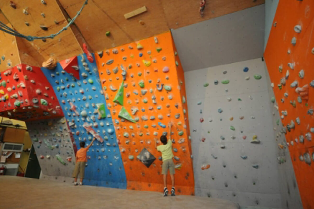
Climbing walls in Kavala
Photo by climbing-greece.com
Useful information
Address
Greek Mountaineering Association of Kavala 1933
Votsi 5, 65201 Kavala
Website
Rock climbing sector of Petropigi
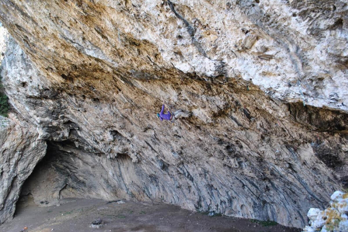
Photo by climbing-greece.com
The rock climbing sector of Petropigi, otherwise known as the Blue Zina Cave, is approximately 25 km from Kavala and is a popular destination all year round. This is a very particular kind of rock climbing sector as its main features are its “overhang” and the great beauty of the routes. For those climbers who visit it regularly, it is certainly the biggest school for climbing with an “overhang”. There are over 40 routes, all of which are sport routes. Routes are available for all levels, although even the easiest routes will be quite tough for those climbers not familiar with an overhang. The Blue Zina cave is a sector that is suitable all year round and is shadyfor almost the whole day.
Access
The website www.climbing-greece.com describes access as follows:
Drive as far as the exit for Keramoti, which you will find approximately 25 km after Kavala. Turn right after the exit. After 500 m you will see a sign for Petropigi on your right. Continue right and you will enter the village. From the village of Petropigi continue until you pass the bridge across the motorway and you come to the other side. The dirt road, in relatively good condition, starts here. Continue along the dirt road until you come to the large open area where you can leave your car. From here, ascend for 30 m and you will see where the footpath starts on your left (total walking time of 20 minutes). The footpath is marked throughout with red spray, so you will have no problem finding the sector.
Rock climbing at Kranohori
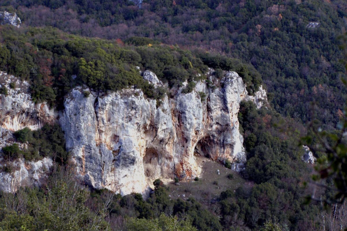
Photo by climbing-greece.com
The rock climbing sector of Kranohori is one of the newest sectors in the Regional Unit of Kavala and was only equipped with routes in early 2009. It has approximately 20 routes, all sport routes and for all levels of climbers. This is a very beautiful climbing sector, within nature and shaded in the summer months. It has a western orientation, and so the routes that are located within the dome can be climbed all year around.
Access
The website www.climbing-greece.com describes access as follows:
Drive in the direction of Drama until you pass the village of Amygdaleonas and continue along the road for Palia Kavala – Lekani – Koryfes. After these 30 km, you will see the village of Polynero on your right. Take the turning for Polynero and, as soon as you enter the village, you will see a small sign for Kranohori. Continue driving for another 500 m approximately towards Kranohori, and on your left you will see a trough. Immediately after the trough, you should notice a large arrow in red spray on your left. Leave your car here. The footpath is marked with red spray and goes in the direction shown by the arrow, so you should not have any difficulty reaching the rock climbing sector. This walk is easy and takes approximately 20 minutes.
Rock climbing at Kokkina, Irakleitsa
Photo climbing-greece.com
The rock climbing sector of “Kokkina” is located in Nea Irakleitsa. This sector is located directly next to the sea, in this way offering climbers who visit it the unique sense of climbing over the sea. It is one of the largest sectors in Kavala, with over 50 sport routes as well as more traditional routes, with the use of “gear” and “friends”.
Access
The website www.climbing-greece.com describes access as follows:
After Nea Irakleitsa and in the direction of Nea Peramos, you will drive up the ascending road until you reach its end, where there is a petrol station on your left. After 100 m you will see a stop on your left, from where a narrow road starts. Take this road and continue until you reach the fence. Park your car and follow the footpath behind the fence, which begins right next to the olive tree. The walk from the car takes approximately 15 minutes.
Remvi
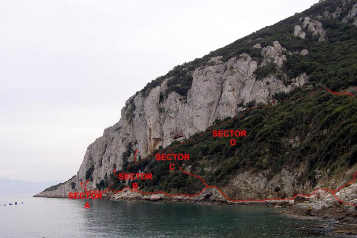
Photo by climbing-greece.com
The rock climbing sector of Remvi is located next to Nea Irakleitsa. There are over 90 routes for all levels of difficulty, mostly sport routes but also traditional ones using “friends” and “gear”. Almost all routes are equipped with permanent anchors and the sector is shaded throughout the day, making it ideal in summer and almost unsuitable in the winter. Climbing in Remvi is a unique experience as the sector is located above the sea.
Access
The website www.climbing-greece.com describes the access as follows:
1st way: Take the exit for Nea Irakleitsa. Do not enter the village but continue ascending for Nea Peramos. As soon as you reach the end of the ascent, you will notice a petrol station to your left. Approximately 50 m after the petrol station, on your left, there is a bus stop. Turn left immediately after the stop into the little road. Continue straight ahead for approximately 5 minutes, and you will effectively come out above the rock climbing sector. Unless you have a 4×4, it is difficult for a car to reach this point. If you do not have a 4×4, park at one of the open areas on the dirt road and walk down by foot for 10 minutes. It is easy to find, as the rock climbing sector can be seen from the point where you leave your car.
2nd way: Enter Nea Irakleitsa and take its coastal road next to the marina. Take this road until you reach the car park. From here, follow the footpath that will lead you to the rocks, right next to the sea. Walk until you are almost beneath the rock climbing sector; the walk from the car takes approximately 20 minutes. This way is preferable when the road is damaged due to continuous rains and it is impossible to descend with your car by the first way.
Koukouvagia Cave
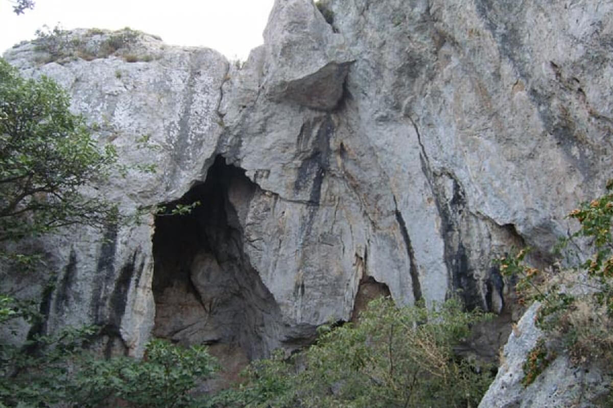
Photo by climbing-greece.com
Koukouvagia Cave is a rock climbing sector that is also located in Nea Irakleitsa. All the routes are sport routes and are equipped with anchors. This sector is for advanced climbers and the easiest route has a grade of 6c+. All the routes have an overhang and require much endurance. This is an ideal climbing sector in the summer as it is shaded throughout the day. Climbing here is a great experience, because of the morphology of the rock, which is mainly tufa “columns” and tufa “blobs”.
Access
The website www.climbing-greece.com describes the access as follows:
Access is very easy. Follow the same route as for the Kokkina and Remvi sectors. You have two choices at the characteristic curve that ascends to the dirt road. One is to park your car in the open space in front of the fence at the olive tree and to walk uphill for about 30 m until you find the path that leads to the cave. This is a typical path in the middle of the ascending slope, and so you will not have trouble finding it. The other option is to drive up to the open space at the end of the ascending road and to park there. To reach the footpath, just go down halfway and you will find it on your left. The walk from the car to the cave takes around 15-20 minutes. The route is marked.
Giola – Thassos
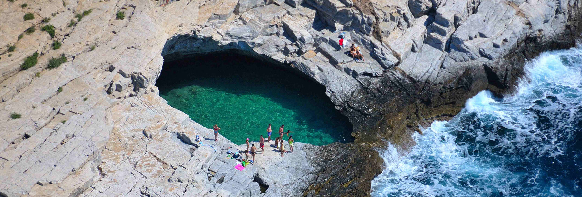
Photo by Artware
Giola is a beautiful place, where you can combine a swim with deep-water soloing. It is located in the southern part of Thassos, past Archangelos Monastery. Climbing in Giola requires particular attention as the water level depends on the daily tides, which push the water into the natural pool. The highest point of the rock is approximately 10 metres, and there are currently several lines for climbing.
Access
The website www.climbing-greece.com describes the access as follows:
To reach Thassos and Giola beach, you can take a ferry from either Kavala or Keramoti.
If you choose to take the boat from the port of Kavala then you will arrive at Prinos. From Prinos, take the road for Skala Kallirachis, Skala Marion, Limenaria, Poto and, finally, you will reach Archangelos Monastery. You can leave your car in the open area of the road to your right. The distance by car is 37 km.
It should be mentioned that the distance between Kavala and Keramoti is approximately 40 km. From Keramoti, the journey takes 30 minutes and reaches the port. From here, follow the signs for Makryammos, Chrysi Ammoudia and Kinyra, after which you will see signs for Archangelos Monastery. Approximately 500 m past the monastery you will see an open area in the road on the left where you can leave your car. The descent to Giola takes about 15 minutes, along a relatively easy path. The total distance by car is about 40 km.
SEE ALSO
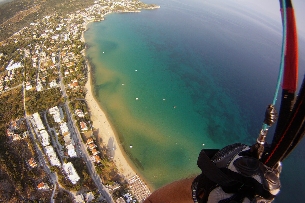
Paragliding – Free Fall – Rafting
Are you adrenaline enthusiasts? If you are looking for a way to enjoy Kavala from above or if you...
Learn more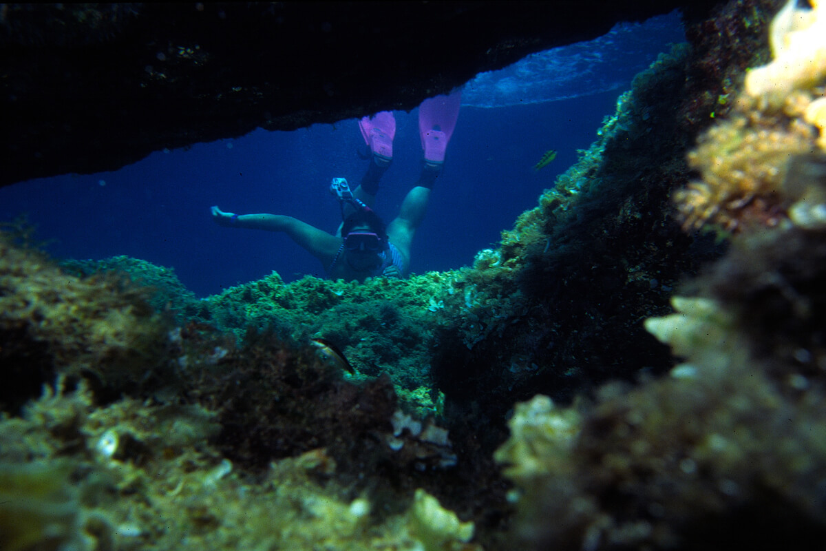
Scuba diving
The clean and calm waters of the region of Kavala are ideal for scuba diving. In addition to the...
Learn more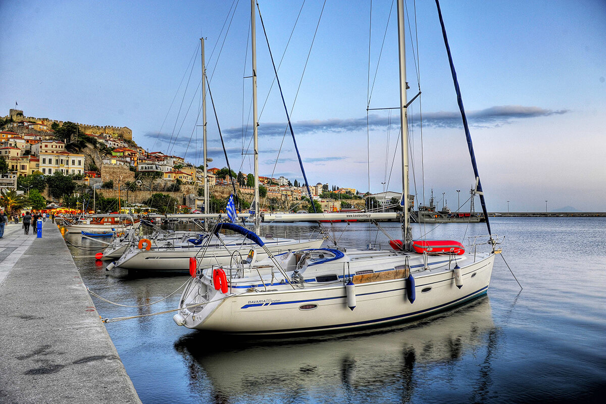
Yachting
When you combine the charm of the landscape with that of the sea, then Kavala is surely the ideal...
Learn more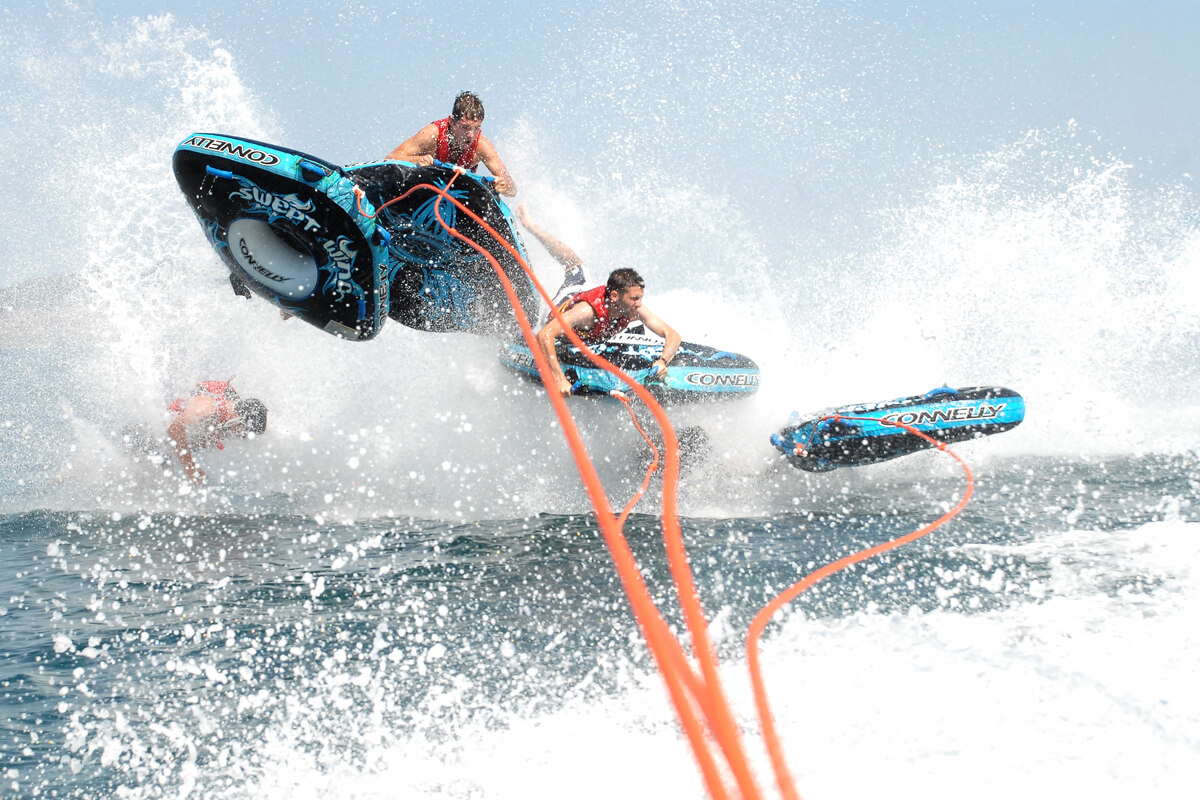
Water sports
Are you a lover of adventures at sea? If you are looking for a suitable spot in Kavala to...
Learn more